Skip to Main Content
Workshop Intermediate AGPL 3.0

Hands-on usage of CoRE stack datasets and APIs for social-ecological planning

Proposal status is Rejected
Session Description

The CoRE stack is a digital public infrastructure that has brought several geospatial datasets and pre-computed analytics together to build a comprehensive social-ecological understanding of a place. The datasets and outputs are hosted freely on the CoRE stack platform and accessible via APIs. Participants will be taken through a process on how to use the APIs to work out several relevant use-cases. A few such examples are listed below:

- Find the most drought sensitive villages in a tehsil: CoRE stack APIs can be used to pull pre-computed data of villages and watersheds in a tehsil of the time-series of cropping intensity since 2017, indexes like NDVI, drought and non-drought years, etc. These dataframes can be quickly analyzed to find which villages or watersheds show the highest sensitivity to droughts. Further data of the socio-economic situation of villages drawn from the census can be used to prioritize targeted drought protection programmes.

- Do an impact assessment of watershed development works: Similarly, to evaluate how successful a watershed development programme has been, the data pulled through CoRE stack APIs can be used to identify counterfactual watersheds based on co-variates like terrain, soil, drought occurrence, etc. and compute the difference in difference of outcome variables (cropping intensity, NDVI) between post-treatment and pre-treatment years in the treated and counterfactual watersheds.

We will also facilitate participants to install a local instance of the CoRE stack backend on their machines, and to build simple pipelines that can run locally installed geospatial libraries to create new data layers and analytics, or invoke Google Earth Engine APIs to trigger layer computations remotely and download the computed outputs, and add these layers to the backend.

Participants will thus gain a strong understanding to use the CoRE stack and contribute to it, as well as learn several geospatial programming tactics to use GEE and other platforms.

Key Takeaways

Participants should have Internet access, platforms like QGIS pre-installed on their machines, programming environments like Jupyter notebooks, familiarity with the Google Earth Engine platform, and should have received CoRE stack API keys after having completed a registration process on the CoRE stack dashboard.


References

Session Categories

Tutorial about using a FOSS project
Introducing a FOSS project or a new version of a popular project
Technology architecture
Talk License: AGPL 3.0

Which track are you applying for?

Main track

Speakers

Aaditeshwar Seth
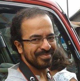
Aaditeshwar Seth Professor, Department of Computer Science and Engineering | IIT Delhi

Aaditeshwar Seth is a professor in the Department of Computer Science and Engineering at the Indian Institute of Technology Delhi, and co-founder of the social technology enterprise Gram Vaani and of the CoRE stack infrastructure and network. He is passionate about building appropriate technologies and participatory tools that can empower marginalized communities to collectivize and voice themselves, and especially to build climate resilience. Several million people, and over 200 organizations worldwide, have directly touched technology platforms built by Aaditeshwar’s team at Gram Vaani, the CoRE stack, and his students at the ACT4D (Appropriate Computing Technologies for Development) research group at IIT Delhi. Many elements of their work have also been adopted by government departments and have influenced the use of technologies for development in the social sector. He is a recipient of the ACM SIGCHI Social Impact Award for 2022. His book published in 2022, Technology and (Dis)Empowerment: A Call to Technologists, argues that the primary goal of technologists should be to bring equality and overturn unjust social and economic structures through their inventions.